
Town of Poughkeepsie ZIP Coverage
The Town has several delivery possibilities rather than one municipal ZIP code. The Town Court names 12601, 12602, 12603, and 12604 in its service area, while the Ward Structure table also identifies Town street ranges using 12590. The table keeps the evidence at the level the official local material supports. For 12602 and 12604, the routing is documented but the exact delivery territory or type was not fully established, so an address-level USPS check remains necessary.
| ZIP code | Town coverage supported | Postal routing | Local note |
|---|---|---|---|
| 12590 | Portions of Town ranges, including parts of Sheafe Road and School Street | Wappingers Falls | Coverage is number-range specific |
| 12601 | Town portions and Poughkeepsie-area delivery ranges | Poughkeepsie 12601 | Not the same as the City boundary |
| 12602 | Town Court service area and Poughkeepsie routing | Poughkeepsie 12601 routing | Exact territory or delivery type was not located |
| 12603 | Town official address and many Town routes | Poughkeepsie 12603 | Town Hall uses this delivery ZIP |
| 12604 | Town Court service area and Poughkeepsie routing | Poughkeepsie 12603 routing | Exact territory or delivery type was not located |
A ZIP code directory should never turn the table into a substitute for an exact address. Postal labels are delivery conventions, while the Town, City, parcel, ward, and court jurisdictions have their own boundaries.
Town of Poughkeepsie ZIP Boundaries
ZIP boundaries and municipal lines do not match in the Poughkeepsie area. A Town address can use a Poughkeepsie postal name, and a road can cross into a Wappingers Falls delivery range without changing its Town context. The City of Poughkeepsie is a separate municipality, so a City clerk or city-only genealogy channel should not be chosen merely because the address says Poughkeepsie.
For a record search, municipality is the deciding field. ParcelAccess and the County Clerk document index distinguish Town of Poughkeepsie from City of Poughkeepsie. The ZIP is still useful for checking a delivery address, narrowing a voter-match form, or interpreting an old directory or newspaper label. It is not proof that a property lies within the Town or that a person currently occupies it.
Address check. Keep the delivery ZIP, municipality, parcel location, and tax mailing address as separate fields. They can agree, but they are not interchangeable.
Town of Poughkeepsie ZIP Routing
The official postal material groups 12601 and 12602 with Poughkeepsie 12601 routing, and 12603 and 12604 with Poughkeepsie 12603 routing. That explains why adjacent ZIP codes may share a routing relationship without sharing a defined Town territory. The research did not verify 12602 or 12604 as a particular delivery, post-office-box, or institution-only category. Calling either one a specific type would overstate the record.
That uncertainty is useful. An old envelope, a court reference, or a record index may carry one of those ZIP codes while the property record supplies the jurisdiction. Treat the postal code as a lead to verify, not a reason to merge records that share a surname or mailing label.
Town of Poughkeepsie ZIP Ranges
The Town Ward Structure table supplies the clearest local test for a split street. It pairs number ranges and odd or even sides with wards and ZIP modifiers. On Sheafe Road and School Street, some Town ranges use 12590 and others use 12601. The difference can explain why a directory, tax roll, newspaper item, or delivery record seems to disagree about a street’s ZIP code.
Source: Town of Poughkeepsie Ward Structure.
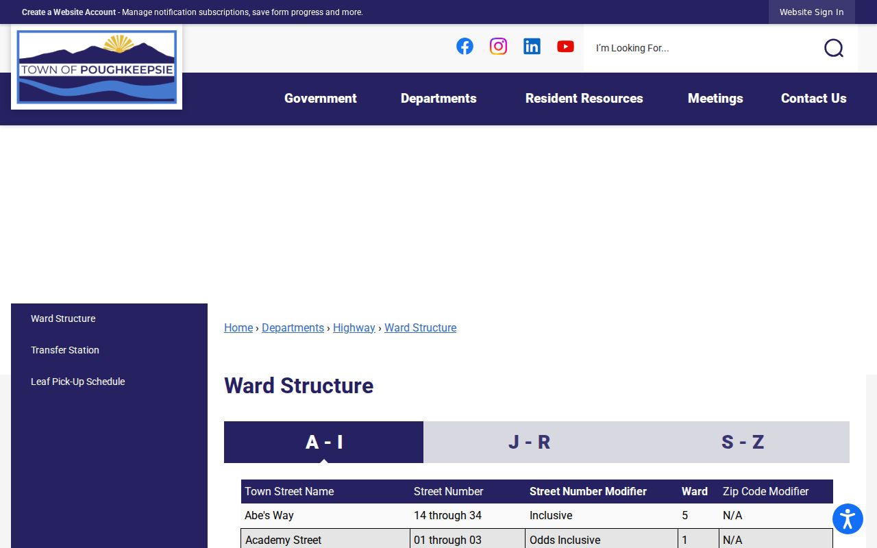
The table is a range crosswalk, not a resident roll. Pair it with an exact address and the municipality shown in the county’s parcel system.
Town of Poughkeepsie ZIP Verification
The official USPS ZIP Lookup accepts a street address with city and state, then returns the ZIP for that delivery address. Use this address-level result before selecting a ZIP on a form or comparing a historic address to a current record. USPS notes that it cannot guarantee a business location, another reason to retain the official parcel and municipal fields for property research.
| Lookup input | How it is used | What the result does not prove |
|---|---|---|
| Street address | Checks delivery ZIP for the exact location | Current ownership or household membership |
| City and state | Directs USPS to the correct delivery area | Town versus City jurisdiction |
| ZIP result | Confirms the postal code for mail delivery | Parcel, ward, or legal-description identity |
Use the result with the Town’s ward table when a road has split ranges. A broad ZIP search may pull nearby areas that do not share a Town record custodian.
Town of Poughkeepsie ZIP Parcels
Dutchess County ParcelAccess does not replace the USPS delivery check, but it supplies the property evidence that a ZIP alone lacks. Address search uses number, street parts, suffix, and municipality. The parcel card can return the parcel location, municipality, owner, primary owner mailing address, districts, assessment, and deed book and page. Address Info-Finder separately returns the structure address, municipality, ZIP, and a report, while cautioning that a structure address is not a mailing address.
Source: Dutchess County ParcelAccess.
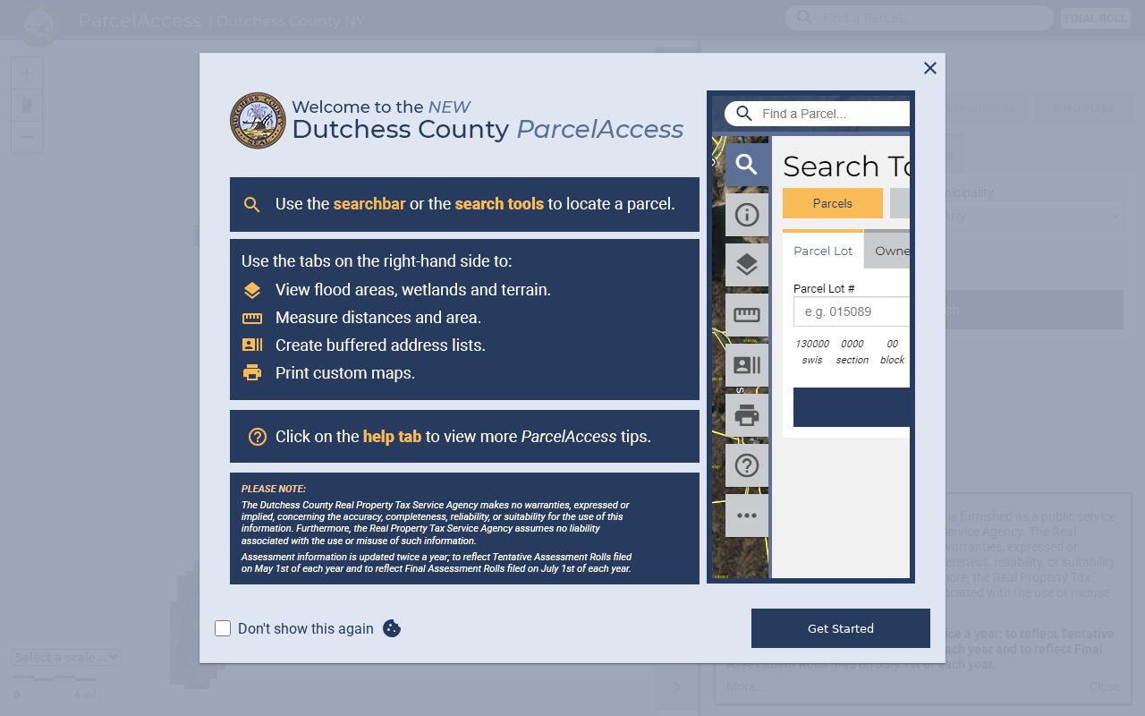
Read the parcel location and primary mailing address separately. A different mailing destination can reflect an agent, trust, owner, or post-office destination, not the structure’s delivery ZIP.
The county’s Address Info-Finder fills a different role. It returns the standardized structure address, municipality, ZIP, map position, and report, while making clear that it does not return the owner’s mailing address. If the structure is missing, its official form asks for the street address and municipality, plus a name and email for follow-up. Questions about county structure addressing can be directed to OCIS at 503 Haight Avenue, Poughkeepsie, 845-486-2450. That correction route is useful when a source uses an address spelling or number that does not resolve cleanly.
Town of Poughkeepsie ZIP Search
A ZIP code can narrow an address task, but the verified Town tools do not create a general ZIP-wide resident list. Begin by validating one delivery address with USPS and then use Address Info-Finder or ParcelAccess to confirm the structure and municipality. Search property records by the address or parcel, not by a broad ZIP alone. If a lawful person-specific voter check is appropriate, the state form accepts ZIP and address information as matching inputs.
- Enter the complete address in USPS ZIP Lookup and retain the returned delivery ZIP with the address exactly as checked.
- Confirm the structure location, municipality, and ZIP through Dutchess Address Info-Finder, which is not a mailing-address tool.
- Search ParcelAccess by address and municipality to identify the parcel, owner field, assessment context, and deed reference.
- Use the Ward Structure table when the street is known to have split ranges or an old source carries a conflicting delivery ZIP.
- For a person-specific voter check, use the official state form only with a lawful purpose and the required identifying details.
Once a ZIP has narrowed the geography, the Town of Poughkeepsie street directory provides the address-by-address parcel and deed sequence.
Town of Poughkeepsie ZIP Fields
The New York State Voter Registration Search is the ZIP-capable official form documented for a person match. It uses County, last name, first name, date of birth, ZIP, and address information. A response concerns registration or polling information, not a downloadable record of all people in a ZIP. County and identity fields prevent a ZIP match from being mistaken for a match to a particular person.
| Voter-search field | Format or role | ZIP research value |
|---|---|---|
| County | Dropdown, used to narrow jurisdiction | Select Dutchess for a Town-related check |
| Last and first name | Identity inputs | Distinguish people sharing an address or postal label |
| Date of birth | MM/DD/YYYY matching input | Used to disambiguate; not a normal public result field |
| ZIP and address information | Location-oriented narrowing inputs | Check the delivery area for the matching search |
Election Law limits the public fields and restricts statewide voter-list use to an elections purpose. Protected voters and ACP participants must not be reverse-engineered from absent or partial results.
Town of Poughkeepsie ZIP Keys
The Town of Poughkeepsie ZIP code directory works best when each address field serves a separate purpose. Postal, property, and deed systems use different labels for the same place. A filed map can connect a lot to a street, and a recorded deed can connect the legal description to a parcel, but neither replaces a delivery check. Preserve the original spelling, number, municipality, and date when comparing sources from different years.
A situs address is the physical location used on the parcel card. A tax mailing address is where notices are sent and can be outside the Town. The parcel number is the assessor and GIS key, while the legal description is the deed key. ParcelAccess can display the deed book and page and offer filed-map routes, then the County Clerk document search can supply the recorded instrument. Keeping those labels separate is especially important when a map, envelope, directory, or deed carries a different version of the same address.
- ZIP and ZIP+4
- A ZIP identifies a delivery area; ZIP+4 adds a more specific delivery segment within that area.
- Post-office-box ZIP
- A ZIP used for box delivery rather than proof of a physical structure location. The exact type of 12602 or 12604 was not confirmed here.
- Unique ZIP
- A ZIP assigned to one organization or delivery arrangement. No Town-specific unique ZIP was established in the research.
- Carrier route
- A postal delivery sequence used to organize mail delivery. It is not a municipal boundary or public resident list.
Note: If the postal and parcel results disagree, verify the exact address with USPS, Town ward ranges, and county GIS before relying on either result.