
Town of Poughkeepsie Street Walkthrough
Start with the location, not a person’s name. Enter the complete address in the Dutchess Address Info-Finder to standardize the structure address, municipality, ZIP, and map point. Then search the address in ParcelAccess, compare the physical location with its owner and deed reference, and keep the municipality visible at every stop. That sequence prevents an address with a Poughkeepsie mailing label from being assigned to the wrong local government.
- Confirm the structure location, street suffix, municipality, and ZIP with Address Info-Finder. Its result is a location address, not a tax mailing address.
- Run the address in ParcelAccess and save the parcel number, current assessed owner, deed book and page, and the parcel’s physical location.
- Use the map’s nearby-parcel view only to understand legal parcels along the same street. It does not identify every person at an address.
- Search the recorded deed by the owner name, municipality, date, and party role in the County Clerk index. Read the legal description before connecting an older record.
- For a historical question, compare a dated street-directory entry with the deed and parcel record, then look for supporting newspaper, probate, or obituary evidence.
That is the practical route through the Town of Poughkeepsie street directory: address, parcel, document, then dated historical evidence. Each record answers a narrower question than a household roster.
Poughkeepsie Street Jurisdiction
The Town of Poughkeepsie surrounds and is distinct from the City of Poughkeepsie. That distinction matters on a street search because City clerk, building, and genealogy material is not the ordinary custodian for a Town address. County systems usually cover both jurisdictions, but their municipality control is what separates Town documents from City documents. Select Town of Poughkeepsie in the deed index and verify the municipality on the parcel card rather than relying on the postal city name.
Postal geography adds another layer. A single road may carry different delivery ZIP modifiers by number range, and a Poughkeepsie post-office label does not prove a City location. The Town Ward Structure table and an exact USPS result are better address checks than a broad place-name search.
Note: Record the municipality beside every street result before comparing it with a deed, map, tax roll, or historical directory.
Town of Poughkeepsie Street Fields
Dutchess County ParcelAccess is the main street-by-street property tool. Its address mode accepts number, predirectional, street, postdirectional, suffix, and municipality. Owner mode instead uses last name, first name, and municipality. A parcel card can show the parcel number, grid numbers, parcel location, owner, primary owner mailing address, land use, assessment, market value, districts, tax code, and deed book and page. The mailing field can lead to another place, but it does not establish present occupancy.
| ParcelAccess route | Fields entered | Street research use |
|---|---|---|
| Address | Number, street parts, suffix, municipality | Find the physical parcel for one structure |
| Owner Name | Last name, first name, municipality | Check the current assessed-owner entry |
| Parcel Lot | Parcel-lot number and municipality | Reconnect a tax-map reference to the street |
| Filed Maps | Map and parcel route | Bridge a subdivision or legal-description question |
The official ParcelAccess search screen is shown below. Use its results as a starting point, then ask the Town Assessor or County Clerk to verify a conclusion that needs official confirmation.
Source: Dutchess County ParcelAccess.
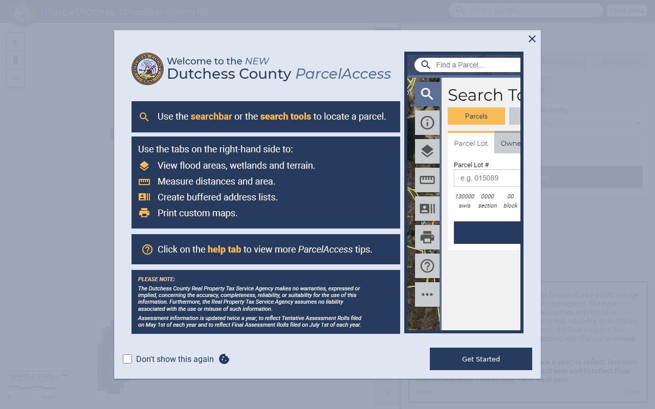
The parcel, sales, assessment, and filed-map tabs are separate paths, so a street search should not assume one result supplies every historical detail.
Map a Poughkeepsie Street
ParcelAccess has tools for a close map reading after the first parcel is found. Choose Current Parcel or Nearby Parcels, pan along the street, and click a parcel card only when the municipal label remains clear. The sketch tool can list parcels within 100 feet, while measure and print tools help preserve a map reference. Aerial, terrain, and lot-line layers can make a street edge or subdivision easier to interpret.
These tools map legal parcels, not households. Adjacent land can be separated by access roads, a lot line, a shared drive, or a different delivery route. When the goal becomes the people connected to one exact address instead of the full street, the Town of Poughkeepsie resident lookup uses a different, name-centered verification path.
Town of Poughkeepsie Deed Chains
The parcel card’s book and page provide the bridge to the Dutchess County Clerk Document Search. Search the current owner as a grantee, narrow by Town of Poughkeepsie, and compare the deed’s legal description with the parcel. The prior grantor can then be searched as an earlier grantee. A deed party may be a grantor, grantee, mortgagee, mortgagor, lien claimant, or another recorded party, so the name alone is not enough.
Computerized deeds generally begin January 1, 1989, with an older deed series from July 7, 1907 through December 31, 1988. When a chain ends online, the historical workflow uses municipality, party type, surname letter, liber, and page to reach older deed books. Free image views carry an unofficial watermark; the County Clerk lists separate purchase, mailed-copy, certified-copy, and office-search routes.
Source: Dutchess County Clerk Document Search.
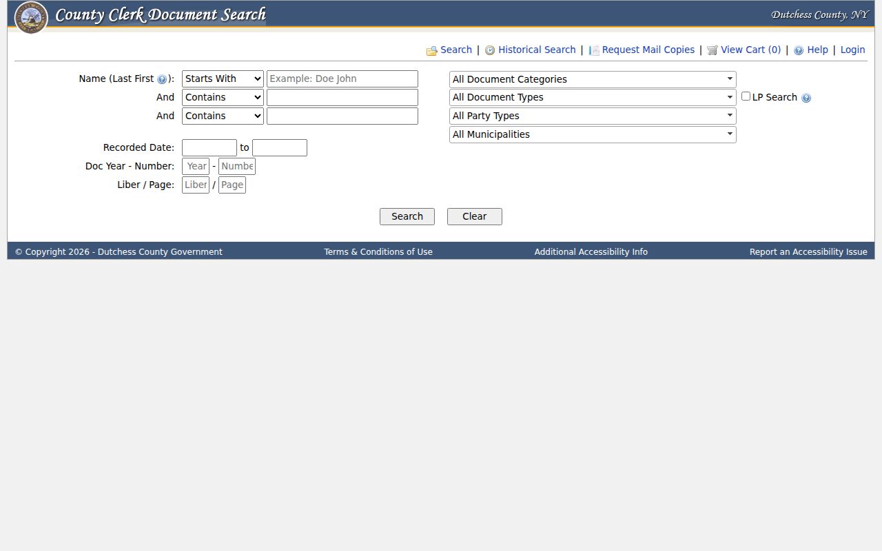
Municipality, party type, document type, date, liber, and page controls help distinguish one Town street record from a similar City or countywide result.
Poughkeepsie Street Range Modifiers
The Town’s Ward Structure table is a local address crosswalk. It lists street and number ranges, odd or even sides, wards, and ZIP modifiers. Portions of Sheafe Road and School Street, for example, use 12590 for Wappingers Falls delivery while other portions use 12601. This is a concrete reason to verify a number range instead of assigning a single ZIP to a road.
Source: Town of Poughkeepsie Ward Structure.
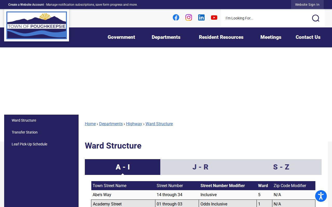
Ward and ZIP entries add geographic context to a street result, but neither turns a parcel-owner record into a list of everyone who lives there.
Town of Poughkeepsie Permit Route
For building and property history, the Town has a Property Search Request rather than a public online permit or code-case database. The form asks for the property owner, address, telephone, grid number, and a mailing address or email for delivery. It offers mail, pickup, or email. Published fees are $150 for one- or two-family property, $150 plus $15 per dwelling for multiple dwellings, and $200 per building plus $25 per commercial space.
The request can lead to public permit, construction, alteration, demolition, certificate, or inspection material where available. It is a manual, fee-based fallback, not a free street search. For non-posted Town material, use the Town’s online FOIL route and describe the address, date range, grid or parcel number, and record type precisely.
Poughkeepsie Voter Address Checks
The New York Voter Registration Search is a person-matching form, not a by-street roster. It uses County, last name, first name, date of birth, ZIP, and address information to narrow a registration and polling response. For a lawful individual check, use Dutchess County and the registered name with the required identifying inputs. Do not treat a nonmatch as proof that no one is connected to an address.
New York law restricts the full statewide voter-list route to an elections purpose. Identification numbers, signatures, full dates of birth, protected-voter records, and ACP addresses are not ordinary public fields. This distinction keeps the street directory focused on address records while respecting the limited scope of voter information.
Source: New York State Voter Registration Search.
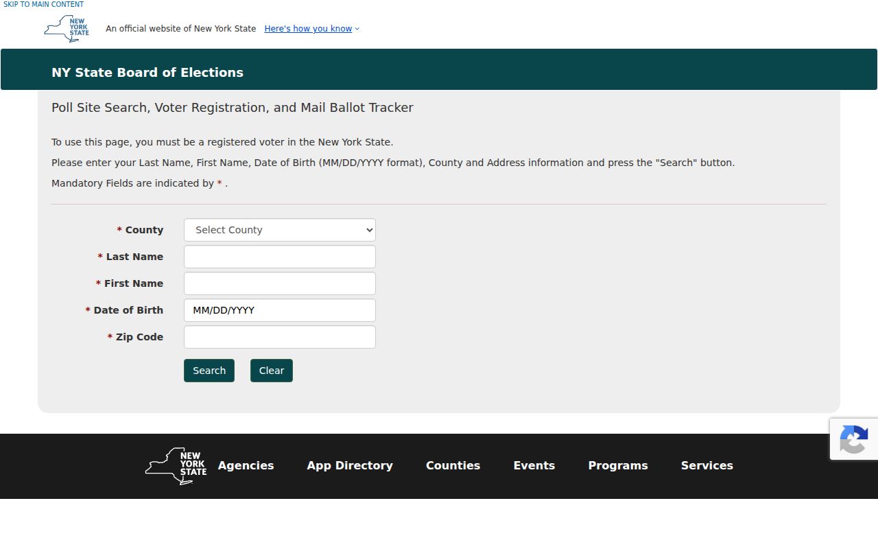
The form’s county, name, date-of-birth, ZIP, and address inputs show why it is designed for a matching voter rather than a street-wide download.
Historic Poughkeepsie Street Sections
Older street research has a different purpose. A reverse or criss-cross directory groups entries by street address, while an alphabetical directory begins with a name and points back to an address. The digitized Poughkeepsie directory collection, Adriance Memorial Library, the Dutchess County Historical Society, and the New York State Library provide useful runs, but their scope can favor the City rather than a Town road. Read the directory’s geographic introduction and abbreviation key before using an omission as evidence.
Street-name history is another check. DCHS records an 1801 street-naming ordinance context and describes Young Street’s 1924 memorial naming for World War I private Giovanni Iondoli, including spelling and name variants. Pair an old street entry with the parcel, deed, newspaper, census, or obituary record that supplies a date and jurisdiction. The Directory Book has the collection-focused route for that longer historical work.
Note: A directory entry is a dated address clue, so retain its year and publisher beside every parcel or deed comparison.
Town of Poughkeepsie Street Records
A strong Town of Poughkeepsie street directory result is built from address-keyed records that answer different questions. ParcelAccess connects a location to an assessed owner and deed reference. The County Clerk connects recorded parties to a legal instrument. Address Info-Finder standardizes the structure location, and the manual Town property-search route may supply property-file history. Historical street sections add a date-specific occupant clue, not a current resident claim.
| Address record | Custodian | What it can establish | Access path |
|---|---|---|---|
| Parcel card | Dutchess GIS and Town Assessor | Parcel, assessed owner, mailing field, value, deed reference | ParcelAccess; assessor clarification |
| Tax roll | Receiver of Taxes and Dutchess County | Assessed parcel and tax-district context | County roll links; payment status is separate |
| Deed or mortgage | Dutchess County Clerk | Recorded parties, date, legal description, book and page | Current or historical index; copy routes |
| Property-search file | Town Building Department | Address, grid, and available permit/property history | Paid request or FOIL |
| Street directory | Adriance, DCHS, and State Library | Historical address or occupant entry | Digital and on-site collections |
The parcel number is the most reliable bridge across map and assessment work. A legal description is the deed key, and the street address is the everyday location label. Use all three when an address has changed, is part of a subdivision, or appears in a dated source.
Town of Poughkeepsie Street Limits
A street search cannot identify every occupant or explain every relationship to a property. An assessed owner can be elsewhere, and a primary mailing address can point to an agent, trust, or post-office destination. Private utility and delivery-customer lists are not public substitutes. DMV personal data is protected, while voter and ACP records have their own statutory limits. The right result may simply be that no public record answers the question.
- Parcel
- A mapped unit of land used by the assessor and GIS system; it may hold one structure, several structures, or none.
- Situs address
- The physical location of the parcel or structure, distinct from the address used to receive tax mail.
- Plat or filed map
- A recorded map that can connect subdivision lots and boundaries to a street location.
- Criss-cross directory
- A historical directory section arranged by street and number rather than by surname.
Lawful use. Use Town of Poughkeepsie street records for personal, lawful research and verification. New York stalking and harassment laws prohibit using address information to follow, threaten, or harm another person.